- 516 Update
- Posts
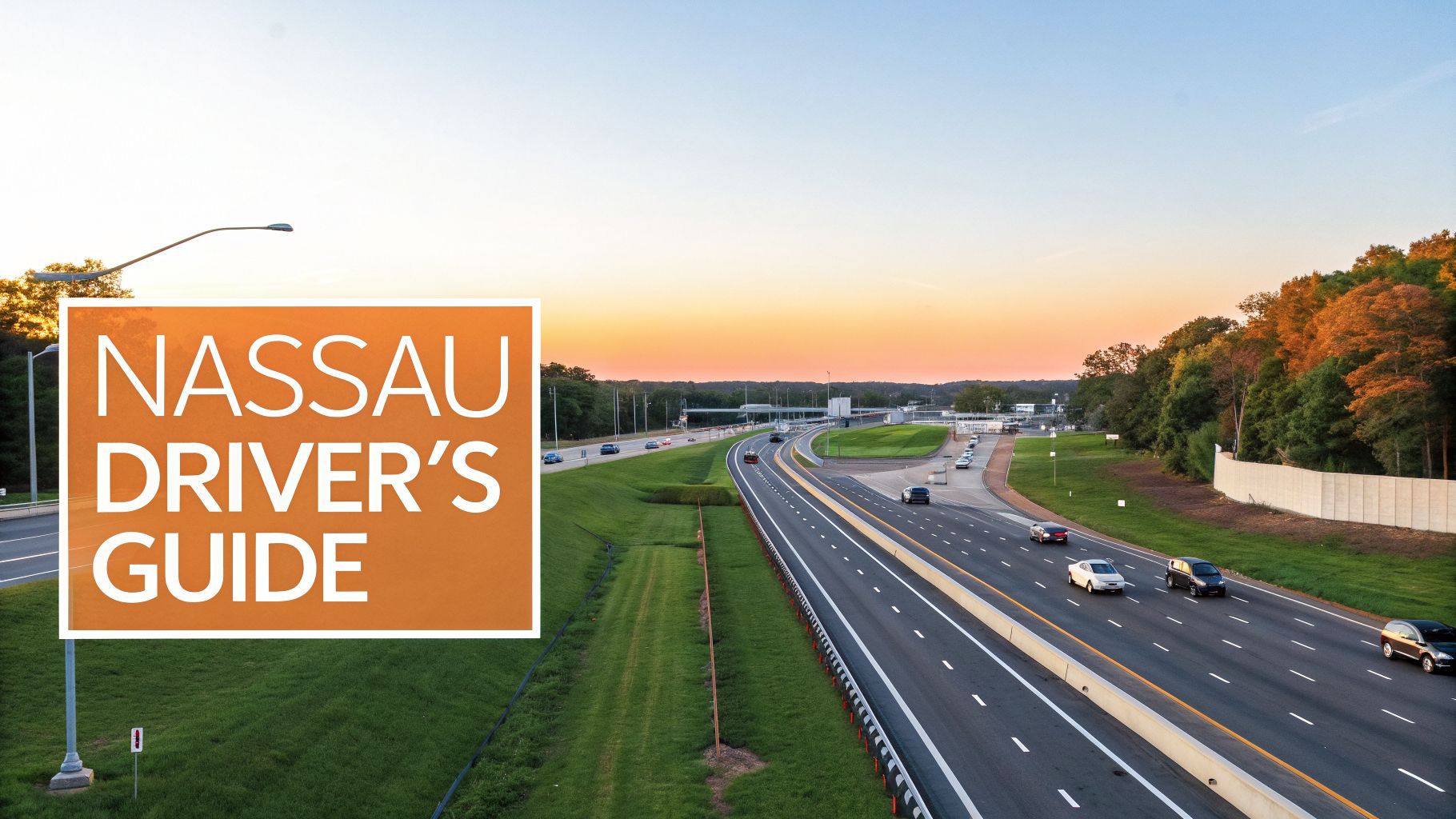
- A Nassau County Resident's Guide to the Long Island Expressway
A Nassau County Resident's Guide to the Long Island Expressway
Master the Long Island Expressway with our complete guide. Get Nassau County exit details, real-time traffic tips, and construction updates for 2026.
516 Update
March 29, 2026

A Nassau County Resident's Guide to the Long Island Expressway
The New York State Department of Transportation (NYSDOT) is gearing up for significant construction on the Long Island Expressway (LIE) through 2026, which will impact daily commutes across Nassau County, NY. In a clear and friendly update for residents, this guide explains what to expect, why it's happening, and how to navigate the changes.
For anyone living in Nassau County, NY, the Long Island Expressway is more than a road—it's the main artery of our daily lives. Known officially as Interstate 495, this highway connects our communities, from Great Neck to Plainview, and takes us to work, school, and weekend destinations like Old Westbury Gardens. While essential, the LIE is also a source of shared frustration due to traffic and construction. This guide is your local playbook for navigating it all with less stress, providing actionable information to make your commute more predictable.
What This Guide Covers
This guide was built specifically for Nassau County drivers. Whether you’re a new homeowner in Merrick or you’ve been commuting from Roslyn for years, here’s what we’ll cover:
Local History: We'll dig into how the LIE was first built and see how it completely reshaped the towns we call home.
Practical Navigation: You'll get an exit-by-exit breakdown of key landmarks and destinations so you're never caught off guard.
Traffic Insights: Learn the daily traffic patterns and, more importantly, where to get real-time updates when you need them most.
Actionable Strategies: We’ll share proven alternate routes and commuting tips that can actually save you time and sanity.
Our goal is to arm you with the kind of details that truly matter. When you understand the geography of our communities and have a solid plan for your commute, it makes all the difference. For a better visual of the area, you can also check out our detailed map of Long Island, NY with zip codes.
Ultimately, we want to make living and working in Nassau County just a little bit easier. By giving you a deeper understanding of the Long Island Expressway, we hope to put you back in control of your travel time.
Ready to become a smarter driver? Let's get started.
How Robert Moses Shaped Your Daily Commute
If you've ever sat in bumper-to-bumper traffic on the Long Island Expressway in Nassau County, NY, you have one man to thank—or blame: the legendary urban planner, Robert Moses. His ambitious vision is the reason Interstate 495 carves its path through our communities. The post-World War II boom saw families flocking to Nassau County, creating the suburbs we know today. However, the existing parkways couldn't handle the commercial trucks needed to build and supply burgeoning towns like Plainview and Jericho.
Moses saw the need for a new kind of road, one that would fuel Long Island's growth.
A New Artery for a Growing Island
The Long Island Expressway was conceived as a commercial superhighway, a powerful artery designed to move not just people, but the goods and materials that would fuel a booming economy. For a rapidly expanding Nassau County, this meant a direct, modern connection to Manhattan. The first section in Nassau County opened on September 30, 1958, a five-mile stretch connecting the Queens border to Exit 37 in Roslyn Heights. For residents in nearby towns like Mineola and Great Neck, it was an immediate game-changer.
From Bold Vision to Overburdened Reality
That initial stretch was just the start. The expressway relentlessly pushed eastward, and with every new mile of pavement, new housing developments and corporate parks sprouted up. Jericho's office buildings and countless new neighborhoods came to depend on the LIE as their lifeline. This matters to residents because the highway, while fueling incredible growth, also locked Nassau County into a car-dependent culture—a decision with consequences we feel every day.
The Expressway was a double-edged sword. It fueled incredible growth and prosperity for Nassau County, but it also locked the region into a car-dependent culture—a decision with consequences we feel every single day.
Here's the rub: Moses and his engineers originally designed the LIE to handle about 80,000 vehicles per day. Today, many of those same stretches in Nassau County see daily traffic volumes of over 200,000. That staggering increase is the root cause behind the gridlock that defines the modern commute from Garden City to Syosset. The road was simply never built for this many cars.
Knowing this history adds a little context to your daily drive. The road under your wheels is a direct link to the post-war dream that built modern Long Island. To get a better sense of the people and events that shaped our area, you might be interested in our deep dive into Nassau County history.
A Nassau County Exit-by-Exit Breakdown
For those of us who drive it every day, the Long Island Expressway can feel like a blur of green signs and exit numbers. But once you know what they mean, those signs stop being abstract numbers and start becoming real, tangible places. Think of this as your personal translator for the LIE, turning exit numbers into the communities, parks, and shopping centers that make up our daily lives in Nassau County.
For instance, when you see the sign for Exit 39, you’re not just seeing a number; you’re seeing the turnoff for the historic charm of Roslyn, with its famous clock tower and beautiful viaduct. Whether you're a new resident trying to find your way or a lifelong local looking to explore, this guide will help you build a mental map of the island.
The LIE we know today didn't just appear overnight. It was the result of a massive post-war boom and the vision of planners like Robert Moses. This map gives you a great visual of how those forces shaped the very road we drive on.
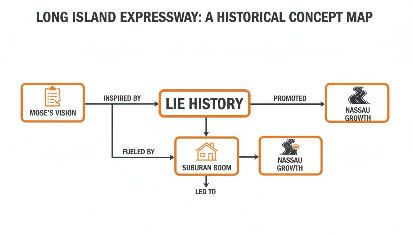
As you can see, Moses’s push for a major commercial artery, combined with the explosive growth of suburbia, made the LIE an absolute necessity for Nassau County's development.
Gateway to the North Shore: Exits 32 to 39
As you cross over from Queens, the first stretch of the LIE in Nassau County serves as the gateway to the picturesque and lively North Shore. These exits are the daily lifelines for anyone living in or visiting towns known for their waterfronts, bustling downtowns, and tight-knit communities.
Exit 32 (Little Neck Parkway): This is where it all begins. As the first official exit in Nassau, it marks the border with Queens and is your primary access to the communities of Little Neck and Great Neck. It's a popular hop-off point for commuters grabbing the LIRR into the city.
Exit 36 (Searingtown Road / Port Washington): A truly major hub, this exit is the main artery for reaching Port Washington, Manhasset, and Roslyn. It's also the route you'll take for St. Francis Hospital and the Americana Manhasset, one of Long Island’s most famous upscale outdoor shopping destinations.
Exit 39 (Glen Cove Road): This is one of the most important exits for navigating the North Shore. Take it north, and you're heading straight into Roslyn and on toward the city of Glen Cove. If you head south on Glen Cove Road, you'll find yourself going toward Carle Place and Westbury.
Getting a feel for these exits helps you move beyond just blindly following a GPS. You start to understand how the North Shore is connected, which makes every trip a little bit easier.
Key Nassau County LIE Exits and Nearby Destinations
To make navigation even easier, here’s a quick-reference table that connects major Nassau County exits on the Long Island Expressway to the key destinations they serve.
Exit Number | Main Road/Town | Nearby Landmarks & Destinations |
|---|---|---|
32 | Little Neck Pkwy | Great Neck, Little Neck, LIRR Stations |
36 | Searingtown Rd | Port Washington, Roslyn, St. Francis Hospital, Americana Manhasset |
39 | Glen Cove Rd | Roslyn, Glen Cove, Carle Place, Old Westbury |
40 | Jericho Tpke (NY-25) | Jericho, Westbury, NYCB Theatre at Westbury |
41 | NY-106 / NY-107 | Hicksville, Bethpage, Broadway Commons, Northern State Parkway Access |
43A | Robbins Ln | Syosset, Woodbury, Corporate Parks |
44 | Seaford-Oyster Bay (NY-135) | Syosset, Oyster Bay (North), Seaford, Massapequa (South) |
This table is a great starting point for planning a trip or simply getting more familiar with how to get around the county using the expressway.
The Central Nassau Hub: Exits 40 to 44
Continuing east, you enter the absolute heart of Nassau County's commercial and residential landscape. These LIE exits are the lifelines for some of the island's largest shopping centers, business parks, and sprawling communities like Plainview and Syosset.
Exit 40 (Jericho Turnpike / NY-25): This exit drops you right into Jericho, a major business corridor. It's also your direct route to Westbury and popular venues like the NYCB Theatre at Westbury.
Exit 41 (NY-106 / NY-107): Think of this as your exit for Hicksville and Bethpage. Taking Exit 41S is the most direct way to get to Broadway Commons mall. This interchange is also where you can easily jump on the Northern State Parkway.
Exit 43A (Robbins Lane): A crucial exit for anyone working or living in Syosset and Woodbury, providing easy access to corporate centers and dense residential neighborhoods.
Exit 44 (Seaford-Oyster Bay Expressway / NY-135): This is one of the LIE's most massive interchanges. It’s the critical connection to the main north-south expressway in this part of the county, taking you south toward Seaford and Massapequa or north toward Syosset and Oyster Bay.
This central section is where so many of us live and work, so knowing these exits can make a huge difference in your daily commute. For local news and updates that directly impact your drive, be sure to subscribe to our daily newsletter and stay ahead of the traffic. You'll never miss an important community update again.
The NYSDOT has announced upcoming construction on the Long Island Expressway through 2026, which is critical news for Nassau County, NY residents. For anyone who drives the LIE, orange barrels are just part of the landscape. But these new projects, designed to tackle safety issues and gridlock, will have a direct impact on commutes from Syosset to Hempstead. The biggest push will be on rehabilitating bridges and maintaining the road surface—necessary work that will bring lane closures but ensure long-term safety.
Why All the Construction?
It’s easy to get annoyed by the endless construction, but this matters to residents because the NYSDOT is trying to bring a very old highway into the modern era. We're talking about a road that carries over 200,000 vehicles every single day in Nassau County alone. This isn't just about filling potholes; it's part of a larger plan with clear, actionable goals for our community:
Boost Safety: Fixing worn-out bridge decks and crumbling asphalt is the most direct way to prevent accidents.
Break Up Bottlenecks: Some projects, like reconfiguring exit ramps near Jericho and Plainview, are aimed squarely at improving traffic flow during rush hour.
Prepare for the Future: These upgrades are about getting the highway ready for the next generation of cars, trucks, and drivers.
Behind the scenes, the planning for this work has gotten a lot smarter. For instance, crews often use drones in engineering to get a precise, bird's-eye view of a work site, which helps make the entire process more efficient and less disruptive than it used to be.
What to Expect in Nassau County
In 2026, if you're commuting through Nassau County, NY, on the LIE, keep a close watch on the stretch between Exit 39 (Glen Cove Road) and Exit 44 (Seaford-Oyster Bay Expressway). That's where a lot of the bridge work will be concentrated.
You can expect single and double-lane closures, but crews will try to stick to overnight hours and weekends to keep the weekday rush hour moving. Still, patterns can change fast, so always watch for the latest signs.
As a matter of community safety, please slow down and stay alert in work zones. This kind of infrastructure work is happening across the island; for example, you can see how similar efforts play out in the $6.8M project to upgrade ramps on the Valley Stream Parkway. For the latest on closures and project schedules that impact your drive, subscribe to our daily newsletter for actionable updates you can use.
How to Beat LIE Traffic and Find Alternatives
If you live in Nassau County, NY, you know the daily ritual all too well. The Long Island Expressway is the lifeblood of our island, but it's also famous for its soul-crushing gridlock. Learning how to navigate it smartly isn't just about saving time—it’s about keeping your sanity. The truth is, you can make your commute less of a guessing game. With a little planning and some local know-how, you can start avoiding the worst of it. Here’s a rundown of the trouble spots and the go-to alternatives that seasoned Long Islanders swear by.
Know Your Choke Points
The first rule of beating LIE traffic is knowing exactly where it's going to jam up. Certain stretches are notorious for backups, especially during the peak rush between 7:00-9:30 AM westbound and 4:00-7:00 PM eastbound.
Common LIE Bottlenecks:
The Queens Border: As you approach Exit 32 (Little Neck Parkway), traffic from Nassau and Queens collides, creating an almost daily slowdown.
The Northern State Merge: Near Exit 41 (NY-106/107) in Hicksville, cars weaving on and off the Northern State Parkway cause a significant bottleneck.
The Seaford-Oyster Bay Interchange (Exit 44): This huge interchange near Plainview is a constant source of congestion as drivers merge onto the major north-south expressway.
Knowing these spots are ahead gives you a critical choice: tough it out on the expressway or bail for a side road before you're trapped.
Master the Parallel Routes
When the LIE is a parking lot, your best move is to get off and use the surface streets. It might feel counterintuitive, but these parallel roads will keep you moving when the expressway is at a dead stop.
Think of the LIE, the Northern State, and Jericho Turnpike as three parallel ribbons stretching across Nassau. If one is tied in a knot, you can usually hop over to another to keep moving.
Northern State Parkway: For passenger cars, the Northern State is your primary escape route. If your traffic app shows a major accident on the LIE, jumping over to the parkway can easily save you an hour.
Jericho Turnpike (NY-25): This is your main surface-street alternative, running right alongside the LIE through towns like Jericho, Syosset, and Woodbury. The traffic lights mean it's slower, but it’s a lifesaver when the expressway is completely gridlocked.
While you're navigating these routes, a quick refresher on traffic laws can also make for a smoother, safer drive for everyone. It's always a good idea to be clear on the important Move Over Laws to protect emergency crews and fellow drivers.
Use the HOV Lane
The HOV (High-Occupancy Vehicle) lane is probably the most underused weapon in the fight against LIE traffic. During peak hours, it’s restricted to vehicles with at least two people, plus motorcycles. This lane was added back in 1991 to help manage the growing volume on a road designed in the 1950s for a tiny fraction of today's cars—a project that originally cost around $500 million.
Ditch the Car Altogether
Sometimes, the best way to beat the traffic is to not be in it at all. For anyone commuting into the city, the Long Island Rail Road (LIRR) is a far less stressful option.
With major hubs across Nassau County, it's a very practical choice.
Mineola Station: A central point where several LIRR branches converge.
Hicksville Station: One of the busiest stations on the entire island, with frequent express and local service.
Ronkonkoma Branch: This line serves many towns in central Nassau and provides a straight shot to Penn Station.
Catching the train from a station like Hicksville or Mineola turns a frustrating crawl into time you can actually use. To see which lines and stations work for you, take a look at our comprehensive guide and map of the LIRR.
Your Top Questions About the Long Island Expressway
If you drive in Nassau County, NY, you've definitely got an opinion about the LIE. Whether you're a new driver just getting your bearings or a seasoned commuter who has seen it all, a few questions always seem to pop up. Let's clear the air and answer some of the most common ones.
What Are the HOV Lane Hours in Nassau County?
That coveted HOV lane can be a real time-saver, but only if you know the rules. It’s strictly for vehicles with two or more people (motorcycles are okay, too) and operates only during the busiest weekday travel times.
Westbound (heading toward the city): 6:30 AM to 10:00 AM
Eastbound (heading out east): 3:00 PM to 7:00 PM
Always keep an eye on the electronic signs at the lane entrances. While these are the standard hours, they can change for holidays or special circumstances.
Why Is It Called Both the LIE and I-495?
Everyone calls it "the LIE." It's the local's name, plain and simple. Its official government designation, however, is Interstate 495 (I-495). Think of it like a person's legal name versus their nickname. The I-495 marker identifies it as part of the U.S. Interstate Highway System—specifically, as an offshoot of Interstate 95. But if you ask for directions to "I-495" in Nassau County, you'll get a funny look. It's the Long Island Expressway.
Are There Service Areas on the LIE in Nassau?
This is a big one for families and long-haul drivers. Unlike a turnpike or thruway, the Nassau County stretch of the LIE has no traditional service plazas directly on the highway. If you need gas, a bathroom, or a bite to eat, you have to get off at an exit. The first real rest stop you'll encounter is the Long Island Welcome Center in Dix Hills (Suffolk County), which is eastbound just past Exit 51.
Originally envisioned as a cure for congestion, the Long Island Expressway has become a victim of its own success. Since its full completion on June 28, 1972, daily traffic in Nassau has swelled to over 200,000 vehicles—more than double its intended design capacity of 80,000. This explosive growth mirrors Nassau's suburban boom, but the infamous lack of mass transit planning by Robert Moses has left the highway shouldering a burden it was never meant to bear. You can dive deeper into this history at Molloy University's online archives.
How Can I Get Real-Time LIE Traffic Alerts?
Sitting in a surprise backup is the worst. For the most accurate, live information on accidents, construction, and those infuriating slowdowns, your smartphone is your best friend.
Waze and Google Maps: These are essential. They use crowd-sourced data from other drivers to give you a real-time picture of what's happening and will often reroute you around a jam before you even see it.
NY511: This is the official source from the NY State Department of Transportation. The app and website provide official alerts on closures and major incidents.
Of course, sometimes the best strategy is to skip the drive entirely. To see if the train makes more sense for your wallet, check out our breakdown of how much a monthly LIRR ticket costs.
For more local insights, event guides, and need-to-know news that impacts your daily life in Nassau County, subscribe to the 516 Update newsletter. Visit us at https://516update.com to join our community of over 25,000 informed residents, and be sure to check out our local events page for things to do in your town.